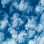
The cycle of condensation which leads to precipitation results in the formation of clouds. Watching clouds for long is great fun because sometimes they seem to appear in various shapes and sizes under different conditions of formation.
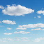
They appear white or grey in colour, but they are actually colourless. They seem to be white because of the tiny droplets of water that comprises it. Due to total internal reflection of light through these innumerable water drops and snowflakes, clouds appear to be white. Here are some more interesting facts about clouds.
-
They are a part of the earth’s atmosphere but never fall on the Earth. They simply float along and evaporate in heat. Sometimes when a cloud becomes too heavy it pours down.
-
This water, in the form of small droplets settle around small dust particles of the atmosphere, or if they are quite cold, they turn into crystals of ice, known as snow flakes or hails.
-
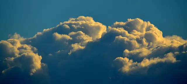
The cloud starts to look grey when it consists of more droplets than it can bear. It eventually turns black and gives way to precipitation. The cloud appears darker when dense as no light gets to pass through it.
-
Depending on the temperature, humidity and pressure, there are different types of clouds like cirrus, cumulus, stratus, stratocumulus, altocumulus, altostratus, and nimbostratus and so on. They are found in various altitudes.
-
A Latin system ‘œLinnaean’ was used earlier to categorize clouds based on species and genre. It was introduced by a skilled meteorologist, Luke Howard and Quaker, back in 1802. Present day differentiation of clouds is done on the theory of Howard and is also followed by International Cloud Atlas as well as World Meteorological Organisation, in 1896.
-
The basic form of cloud at higher altitudes is the Cirrus, which is wispy and thin. They are found at an altitude more than 20,000 feet above sea-level. These clouds are made of ice crystals that take their origin from freezing water droplets.
-
Any cloud can form the Cirrus on undergoing glacial modifications. They can be of various shapes ranging from a small finger to huge mountains. Fall streaks are noticed in this form of cloud after a discharge of hail and snow-flakes.
-
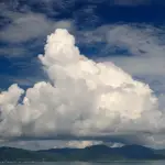
Cumulonimbus clouds are quite large and are taller than regular clouds. The tip of this type of cloud sometimes spreads like an anvil. These clouds can be filled with both water droplets and ice flakes at the same time. This occurs when the freezing point is located in the centre of the cloud.
-
The cumulonimbus clouds result in heavy rain, thunderstorm, snow, and lightning and sometimes bring about tornados, as well. Altocumulus lies at a higher elevation and appears like cotton balls in a parallel unison. A particular part of this type of cloud appears thinner at a particular end. This leads to thunderstorms followed by a warm summer day.
-
Stratocumulus is the cloud that is not responsible for major weather change as they are formed at an altitude lower than 6,000 feet. A thin layer of this cloud is seen around a setting or rising sun while the rest is cumulus in nature.
A cloud generally forms when moist air containing water vapour cools down. At a lower temperature, atmosphere is incapable of holding water as in warm temperatures. Hence a part of the water is moved out of the atmosphere forcibly.


Leave a Reply